Challenge: Collecting precise data in aquatic environments can be difficult due to water movement, sedimentation, and varying depths.
Our Solution:
Advanced Sensor Technology: Utilizing cutting-edge sensors, our systems capture detailed and accurate data on water quality, depth, and other critical parameters.
Multi-Parameter Monitoring: Simultaneously measure multiple parameters, including temperature, turbidity, dissolved oxygen, pH, and more, providing a holistic view of the water body.
Challenge: Continuous and real-time monitoring of water bodies is essential for timely decision-making but can be challenging to implement.
Our Solution:
Real-Time Data Transmission: Our systems transmit data in real-time, allowing for immediate analysis and response to any changes or anomalies detected in the water.
Challenge: Creating accurate maps of underwater environments, including topography and sediment layers, is crucial but can be complex.
Our Solution:
GIS Compatibility: Our mapping data is compatible with Geographic Information Systems (GIS), facilitating easy integration and analysis with other spatial data.
Challenge: Understanding the environmental impact of human activities on water bodies requires detailed and continuous monitoring.
Our Solution:
Data Analysis Tools: Utilize advanced data analysis tools to identify trends and correlations, aiding in the assessment of environmental impact and the development of mitigation strategies.
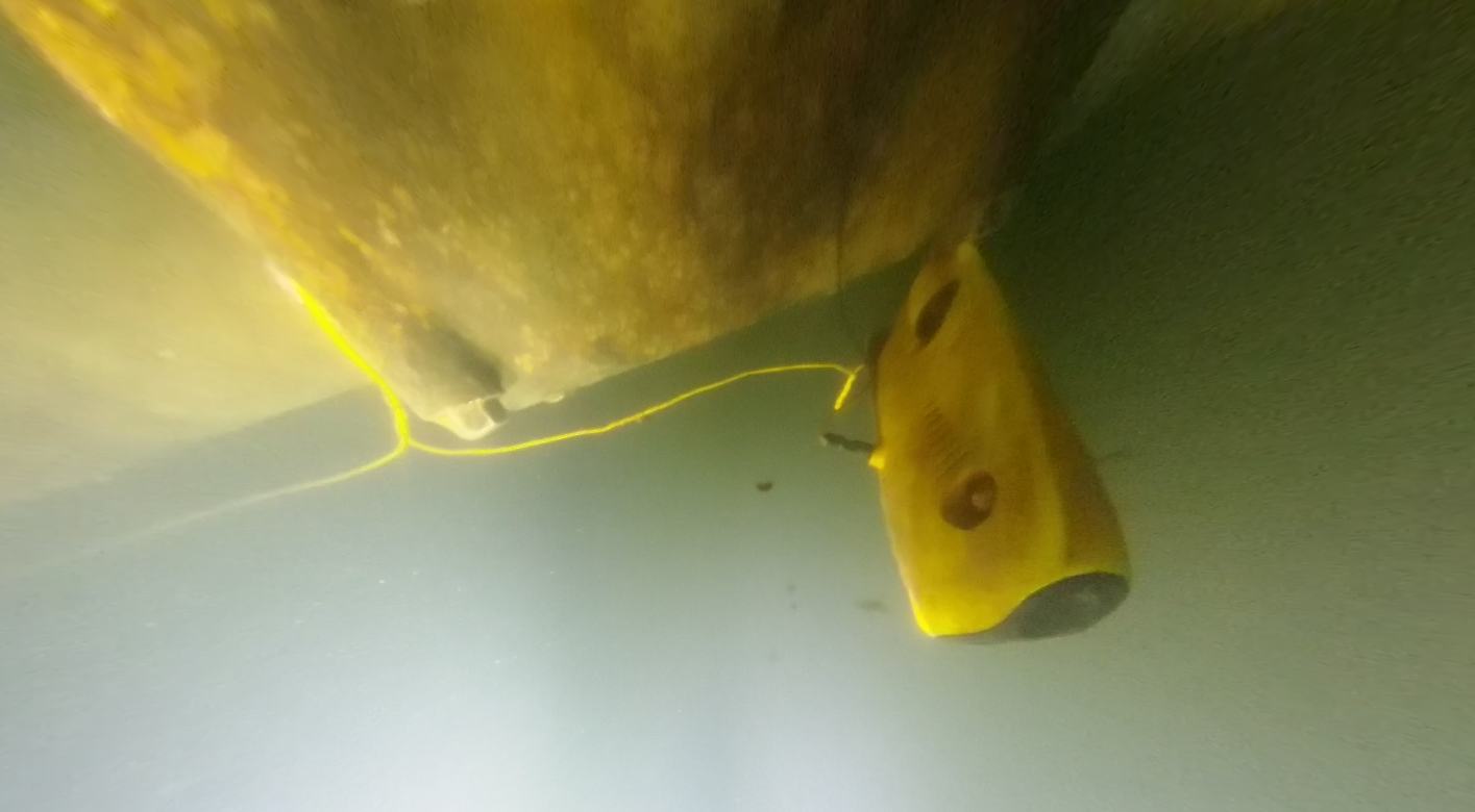
Challenge: Monitoring the condition of underwater infrastructure, such as dams, bridges, and pipelines, is critical for ensuring safety and functionality.
Our Solution:
Regular Inspections: Conduct regular inspections using ROVs and advanced technology equipped with 4K high-resolution cameras and sonar, ensuring comprehensive assessment and timely maintenance.
Infrastructure Inspection: Assessing the condition of underwater structures such as dams, bridges, pipelines, and seawalls.
Hydrographic Surveying: Detailed mapping of seabeds, riverbeds, and other underwater terrains.
Aquatic Research: Supporting scientific research with precise data on water properties and underwater environments.
Precision and Accuracy: Leveraging advanced technology to deliver highly accurate and reliable data.
Comprehensive Mapping: Generating detailed 3D maps compatible with GIS for enhanced spatial analysis.
Robust and Reliable: Ensuring consistent performance in diverse and challenging aquatic environments.
Experience the future of water monitoring and mapping with UAM Tec’s state-of-the-art solutions, designed to solve the toughest challenges and deliver precise, actionable insights.