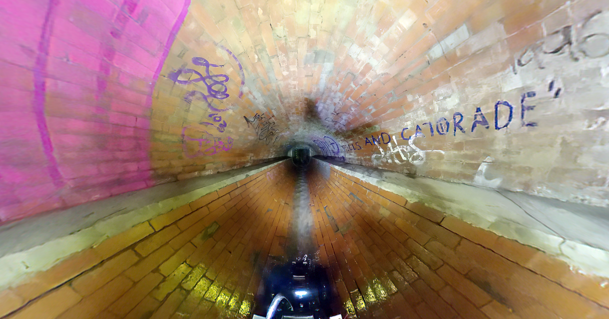
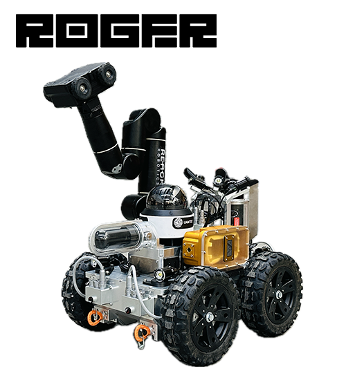
Ground Rover System
Experience unparalleled ground exploration with the Ground Rover (R.O.G.E.R.). Equipped with high-definition cameras, 360 degree LiDAR, and advanced sonar, R.O.G.E.R. navigates confined spaces with ease, providing accurate and actionable data for infrastructure inspections. Perfect for tunnels, manholes, and various underground environments, ROGER's advanced AI and data processing capabilities ensure you get the insights you need.
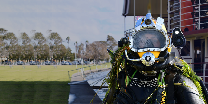
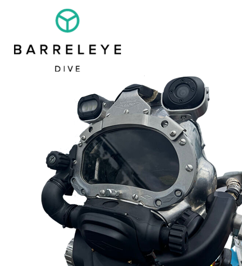
Subsea Camera System
Dive into the future with Barreleye Dive. Our cutting-edge underwater camera system offers ultra-high-definition footage, powerful LED lighting, and comprehensive sensor integration. Ideal for various underwater operations, Barreleye Dive provides unmatched clarity and depth data, enhancing safety and efficiency in underwater inspections and explorations.
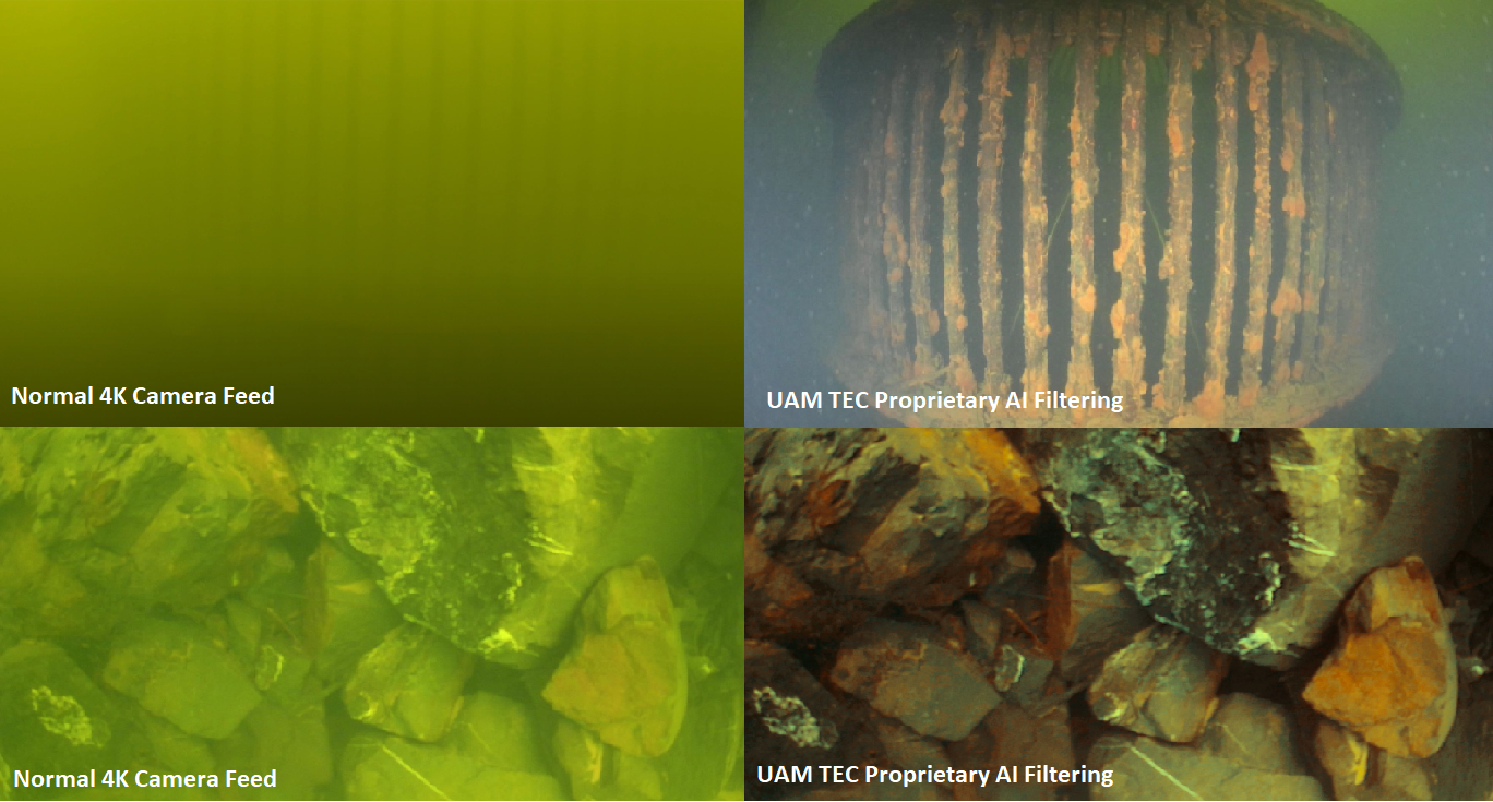
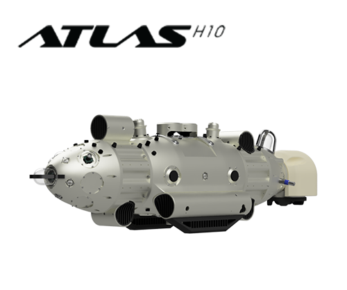
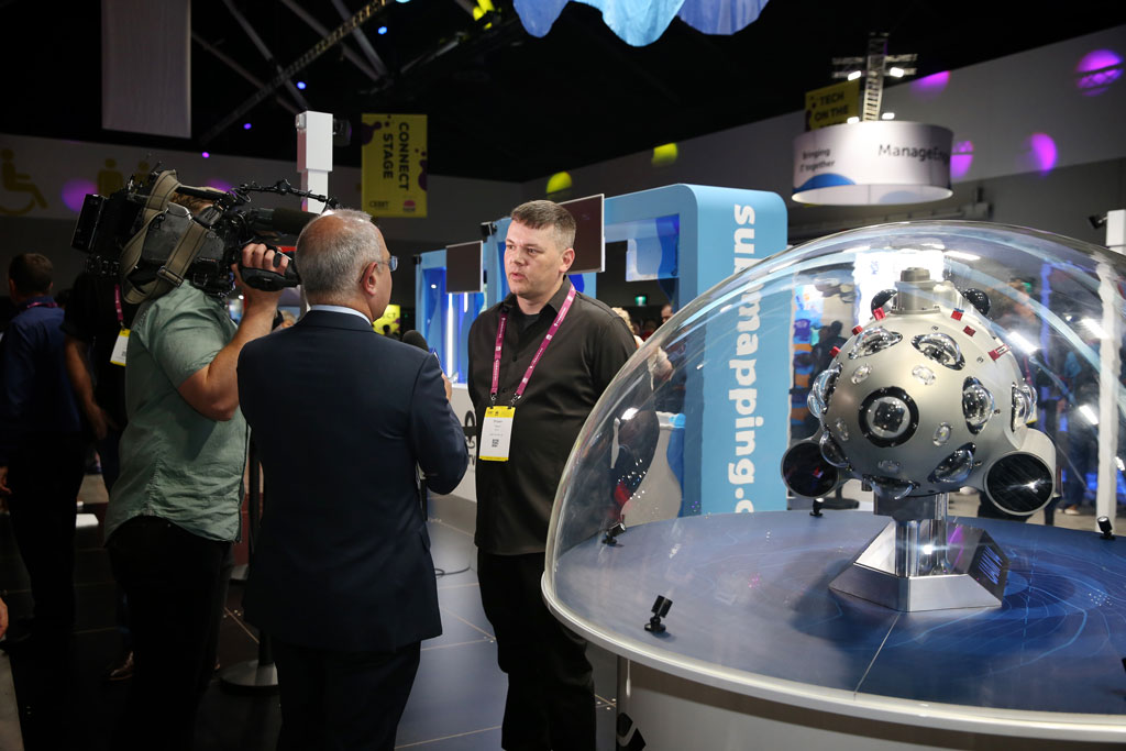
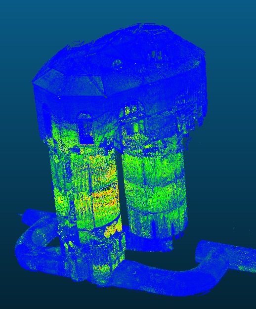
Mapping & Monitoring System
Atlas sets the standard for subsea and underground exploration. Combining the latest in AI, sensor technology, and 4K high-resolution imaging, Atlas delivers precise mapping and monitoring capabilities. Whether you’re exploring deep reservoirs or intricate tunnel systems, Atlas provides the comprehensive data you need to make informed decisions and maintain your infrastructure effectively.
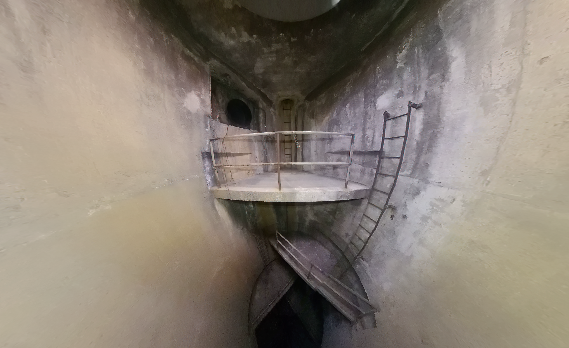
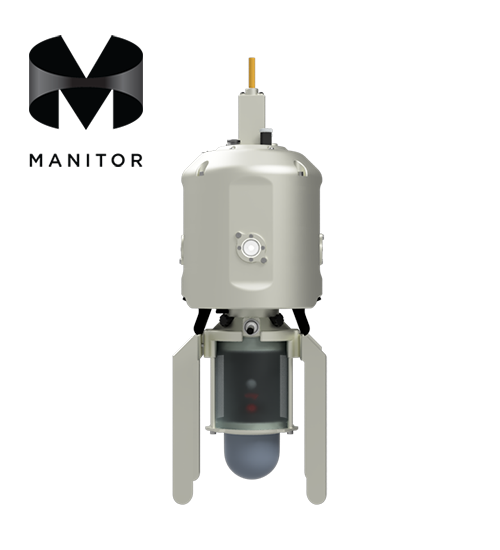
Vertical Inspection System
Revolutionize your vertical inspections with Manitor. Designed for inspecting manholes and vertical shafts, Manitor combines high-definition cameras, 360-degree LiDAR, and advanced sensing technologies. Its robust software suite offers real-time data processing, AI-driven analysis, and easy-to-use client portals, making your inspection process more efficient and reliable.
At UAMTEC, we are transforming subsea and underground exploration with our innovative technology and unmatched expertise.
Our mission is to deliver accurate, efficient, and reliable mapping and monitoring solutions, empowering our clients to make informed decisions and maintain their assets with confidence.
Cutting-Edge Technology: Leveraging advanced sensors, high-definition cameras, LiDAR, and AI-driven software, our solutions offer unmatched precision and efficiency. We stay at the forefront of technological advancements to provide you with the best tools available.
Comprehensive Solutions: From ground exploration with R.O.G.E.R. to vertical inspections with Manitor and underwater explorations with Barreleye Dive, our technology covers all aspects of subsurface and underwater inspections. No matter your challenge, we have a solution.
Proven Success: Our technology has been successfully deployed across various industries, helping clients save time and money while enhancing their infrastructure maintenance. Our track record speaks for itself, with numerous success stories and satisfied clients.
Client-Centric Approach: We prioritize our clients' needs, developing customized solutions and comprehensive support to ensure optimal results. Our dedicated team works closely with you to understand your specific requirements and deliver tailored solutions that exceed expectations.
Reliability and Innovation: At UAMTEC, we are committed to delivering reliable, high-performance solutions. Our continuous investment in innovation ensures that you always have access to cutting-edge technology and the best possible service.
Remote Operated Ground Exploration Rover: Perfect for confined spaces and complex underground environments, providing comprehensive exploration and data collection.
Commercial Diving Camera System: Provides high-definition footage and comprehensive sensor data for safe and efficient operations in various underwater environments, including tank cleaning and other aquatic applications.
Vertical Shaft Inspection System: Ideal for vertical shafts and manholes, offering detailed inspections and in-depth analysis to ensure safety and integrity.
Advanced Mapping and Monitoring Solutions: Combines AI, sensors, and 4K high-resolution imaging for precise subsurface and underwater exploration.
Delve into the world of advanced exploration with UAMTEC. Our innovative solutions are designed to address the diverse challenges of subsea and underground environments. By exploring our detailed sub-pages, you will gain comprehensive insights into each of our cutting-edge technologies.
Each sub-page is packed with detailed information about the specific features, capabilities, and applications of our technology. From technical specifications to real-world case studies, we provide everything you need to understand how UAMTEC can meet your unique needs. Whether you’re looking to enhance your infrastructure maintenance or improve operational efficiency, our technology offers reliable, high-performance solutions tailored to your requirements.
Explore our technology today and see how UAMTEC is revolutionizing the field of subsurface and underwater exploration.